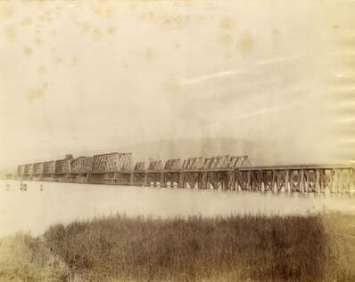
Pitt River Bridge
This is a sepia-toned photograph of the Pitt River Bridge – C.P.R. Railway – 7 miles above Port Moody c. 1880s. In 1885, a CPR line through the area gave Pitt Meadows its first land transportation link (this bridge). The first train into the area following the construction by the C.P.R. was on November 7th, 1885, bringing many settlers into the area. By 1915 water transportation into Pitt Meadows became obsolete since a traffic-based bridge was built to replace ferries across the Pitt River.
Details:
Latitude: 49.2480528483985
Longitude: -122.72970578475
Direct Link: https://www.pittmeadowsmuseum.com/locations/pitt-river-bridge