This artifact is two signs from the Municipality of Pitt Meadows.<\/p>\r\n
<\/p>\r\n
The City had been incorporated as a district in April 1914 and reincorporated as a City on January 1st, 2007. From the 2007 edition of the History of Pitt Meadows, the Curator wrote this about the municipality in the forward. “Pitt Meadows takes its name from the nearby Pitt River, named in 1824 by Captain James McMillan of the Hudson’s Bay Company. At that time, the area was populated solely by the Katzie, members of the Coast Salish People. By the mid-1800s, to encourage settlers, the government sold land in the area for as little as $1 per acre. While many purchasers were speculators, some agricultural settlers did arrive and by the late 1870s, a small community had formed. Industry in the late 1800s consisted primarily of logging and farming – in particular dairy farming. Until 1885, settlers arrived by boat, using the waterways that surround Pitt meadows on three sides. In 1885, a new CPR line through the area gave Pitt Meadows its first land transportation link. Water-based transportation became obsolete in March 1915, when the first traffic-based bridge replaced ferries across the Pitt River. Pitt Meadows was an unincorporated territory until 1881 when it became part of Maple Ridge. However, it reverted back to an unincorporated territory in 1896 when its land owners petitioned for removal from Maple Ridge due to dyking disputes. By 1912, area landowners had petitioned Victoria for the right to form a municipality. On April 25, 1914, Pitt Meadows was incorporated as the District of Pitt Meadows” If you wish to purchase Edith McDermott’s History Book, you can purchase it during open hours at the museum for $10.00.<\/p>","SEO_LINK":"pitt-meadows-signs","VIDEO_LINK":"","SOUNDCLOUD_LINK":"","IMG1":"1718920004_main_pitt-meadows-signs_1.jpg","IMG2":"1718920006_main_pitt-meadows-signs_2.jpg","IMG3":"","IMG4":"","IMG5":"","IMG6":"","IMG7":"","IMG1_THUMB":"1718920004_thumb_pitt-meadows-signs_1.jpg","IMG2_THUMB":"1718920006_thumb_pitt-meadows-signs_2.jpg","IMG3_THUMB":"","IMG4_THUMB":"","IMG5_THUMB":"","IMG6_THUMB":"","IMG7_THUMB":""}X
Pitt Meadows Signs
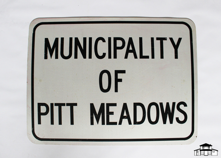
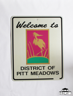
This artifact is two signs from the Municipality of Pitt Meadows.
The City had been incorporated as a district in April 1914 and reincorporated as a City on January 1st, 2007. From the 2007 edition of the History of Pitt Meadows, the Curator wrote this about the municipality in the forward. “Pitt Meadows takes its name from the nearby Pitt River, named in 1824 by Captain James McMillan of the Hudson’s Bay Company. At that time, the area was populated solely by the Katzie, members of the Coast Salish People. By the mid-1800s, to encourage settlers, the government sold land in the area for as little as $1 per acre. While many purchasers were speculators, some agricultural settlers did arrive and by the late 1870s, a small community had formed. Industry in the late 1800s consisted primarily of logging and farming – in particular dairy farming. Until 1885, settlers arrived by boat, using the waterways that surround Pitt meadows on three sides. In 1885, a new CPR line through the area gave Pitt Meadows its first land transportation link. Water-based transportation became obsolete in March 1915, when the first traffic-based bridge replaced ferries across the Pitt River. Pitt Meadows was an unincorporated territory until 1881 when it became part of Maple Ridge. However, it reverted back to an unincorporated territory in 1896 when its land owners petitioned for removal from Maple Ridge due to dyking disputes. By 1912, area landowners had petitioned Victoria for the right to form a municipality. On April 25, 1914, Pitt Meadows was incorporated as the District of Pitt Meadows” If you wish to purchase Edith McDermott’s History Book, you can purchase it during open hours at the museum for $10.00.
Details:
Latitude: 49.2205214931336
Longitude: -122.69000502759
Direct Link: https://www.pittmeadowsmuseum.com/locations/pitt-meadows-signs