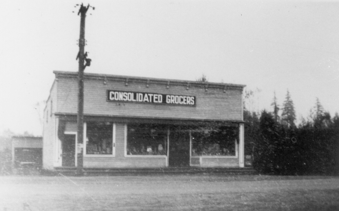
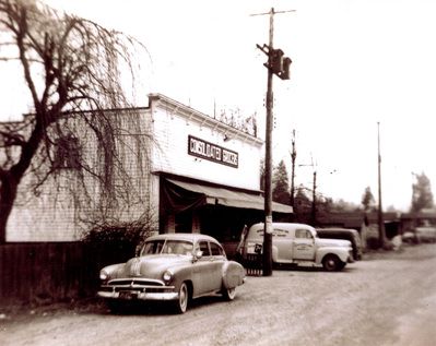
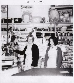
Consolidated Grocers
The first photo shows a building "Consolidated Grocers" on Harris Road. 1930s The second photo shows the Consolidated Grocers building on Harris Road with the store's delivery truck out front. A car is in the foreground and the apple tree on the south side of the old general store building is just visible. 1940s The third photo is of two women, Olive Carruthers and Sharon Roraph, standing behind a counter at Consolidated Grocers. In the background are shelves with items that were for sale. 1966
Details:
Latitude: 49.2257227513850
Longitude: -122.68939148773
Direct Link: https://www.pittmeadowsmuseum.com/locations/consolidated-grocers