The history behind the name of Blom’s crossing. Blom’s crossing (previously called New Neaves Road bridge) is named after Jan Blom. He contributed significantly to Pitt Meadows by initiating the construction of Pitt Polder. Blom was born in the Netherlands. As he grew up in a country primarily made up of reclaimed land, the stage was set for his pursuit of bringing new and better dikes to Pitt Meadows. “Polder” is a Dutch word for reclaimed land. The polder is a piece of low land, reclaimed from a nearby river, surrounded by dikes with a controlled water table, controlled by pumps.
Much of the Pitt Poulder area was under water. Prior to Jan Blom and his team’s construction of the dikes, there had been attempts to reclaim land in the Pitt Polder area. In an interview with the Maple Ridge News, Jan Blom reported, “as far as I know they made the first dike there in 1911 with Chinese workers. They were still here from the railway. They finished the whole works just before 1914. Then, of course, the war started.”
“According to Dr. Jan Blom, prior to 1948, gun clubs hunted for ducks in the polder area until it became too wet even for the ducks because the dikes went altogether because of the flood.” (Maple Ridge News, Wednesday, November 1, 1989).
“The water level was so high that Blom travelled by canoe when he first toured the area.” (Maple Ridge News, Wednesday, November 1, 1989).
In an interview, Blom explains how it all began:
I came here in 1947 for the first time. I got an option on the Pitt Poulder land in 1949. I went back to Holland and talked it over with a number of friends and we thought that it would be an adventure to start it. In 1950, we bought the whole thing practically for nothing because it was a lake, and the cost was not in buying it, but in diking it and draining it. (Maple Ridge News, Wednesday, November 1, 1989).
In 1953, “we had 8,000 acres including the Alouette Polder. There were 7,000 acres in the Pitt Poulder.” (Maple Ridge News, Wednesday, November 1, 1989).
The cost in diking required a Dutch company called Pitt Poulder Ltd. to buy land and establish dikes. It was initially a foreign investment until, the cost became so great that “in 1954, Canadian investors came in with the same amount of money” to meet the expense. (Maple Ridge News, Wednesday, November 1, 1989).
Support for the dikes also came from Pitt Meadows residents who in 1956, pitched it to put sandbags on the dike. (Maple Ridge News, Wednesday, November 1, 1989).
Although the financial backing and support of Pitt Meadows residents was present, it was still challenging to overcome natural obstacles like wind. For example, in 1956, “there was a very fierce wind from the north. We didn’t have the new dike yet over Pitt Lake, and it came in through that funnel. The waves came up, and I think it was a fairly high tide too. That’s the year that we came to the conviction that we still should raise the size of the dike.” This experience guided the engineers on the new plans. (Maple Ridge News, Wednesday, November 1, 1989).
The dikes we see today were built during 1957 and 1958.
Blom’s contribution is significant to Pitt Meadows because without his efforts the Pitt Polder area would be less accessible for farming, hunting, recreation, and golf courses.
In 1989, a cairn was dedicated to him in his honour. On June 2001 New Neaves Road bridge was named Blom’s crossing. That year Jan Blom died on August 17.
<\/p>\r\n
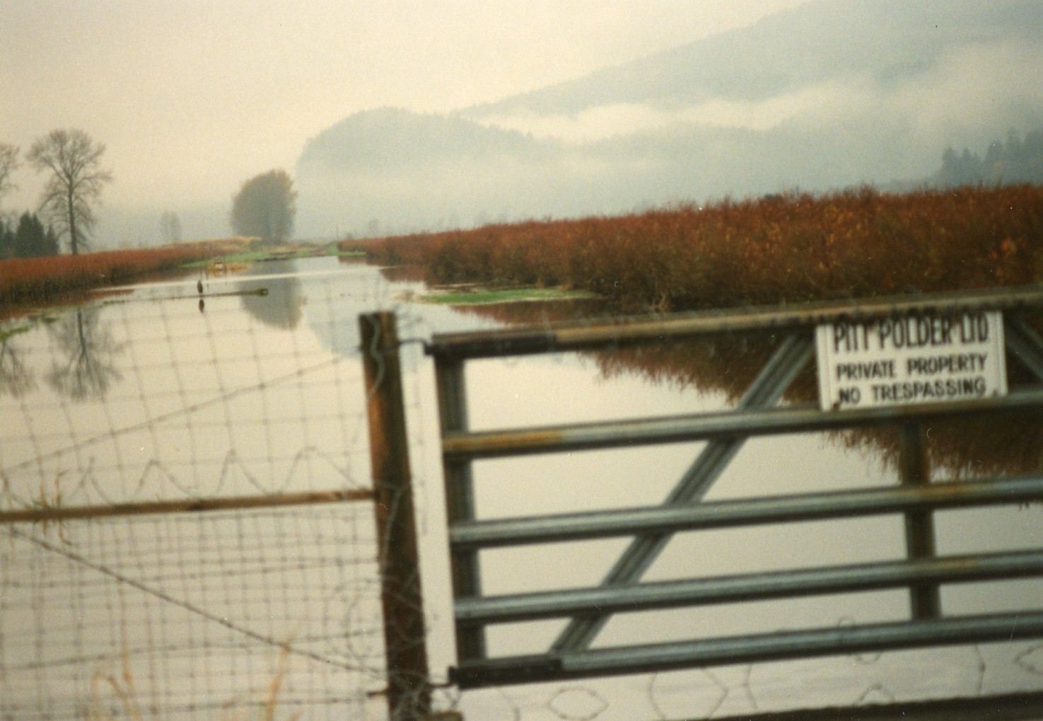
The first photo is of a gate in front of water at Pitt Polder. The sign says \"Pitt Polder Ltd. Private Property No trespassing.\" <\/p>\r\n
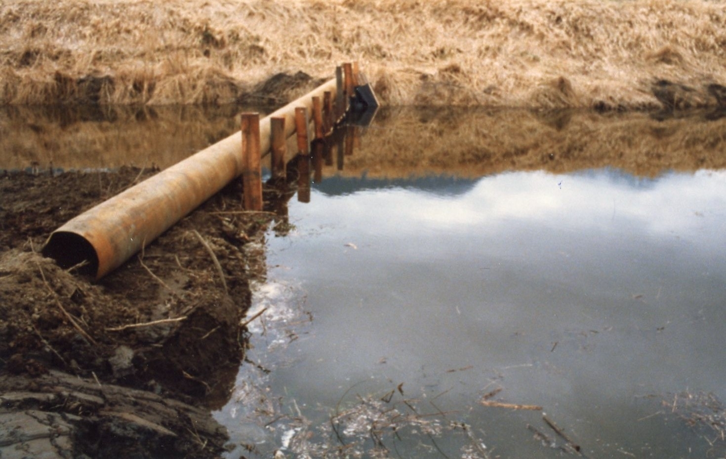
The second photo is of a pipe extending from one side of the dike to the other.<\/p>\r\n
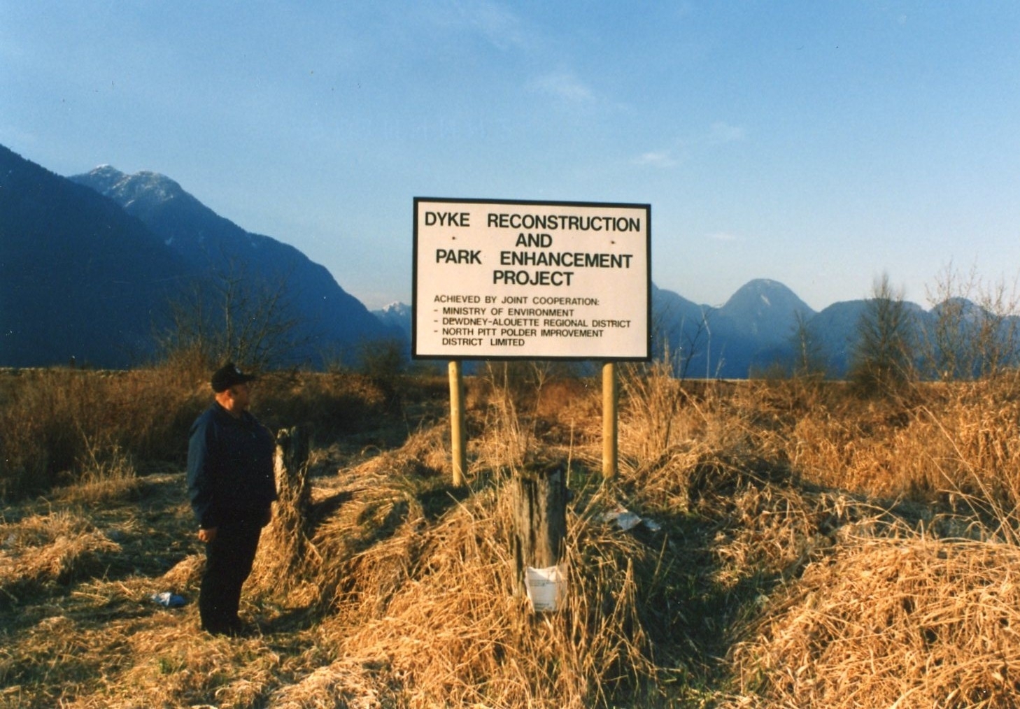
The third photo shows a sign that states \"Dyke reconstruction and park enhancement project,\" with a man standing to the left of the sign.<\/p>\r\n
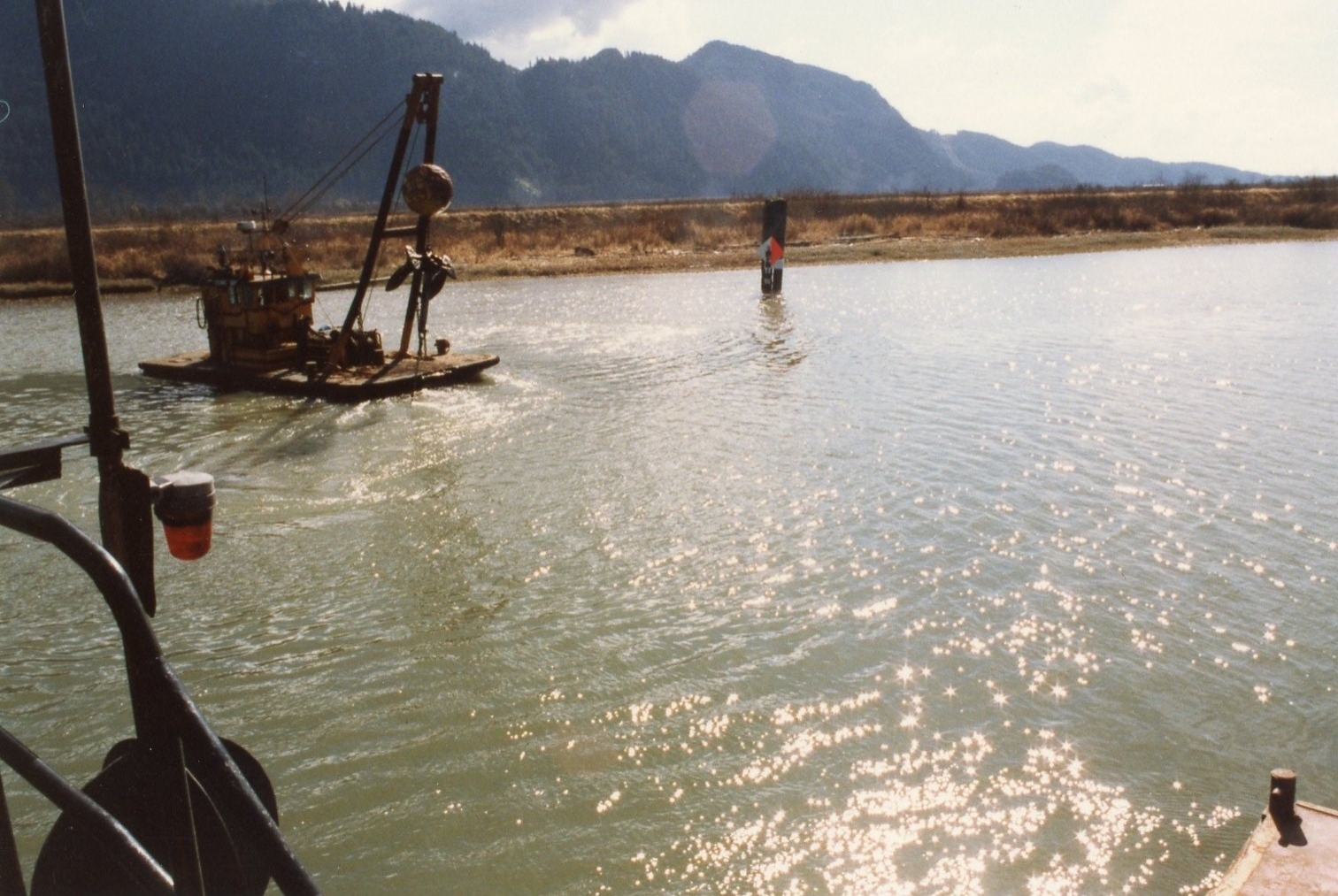
The fourth photo shows a machine floating down a river on a platform.<\/p>\r\n
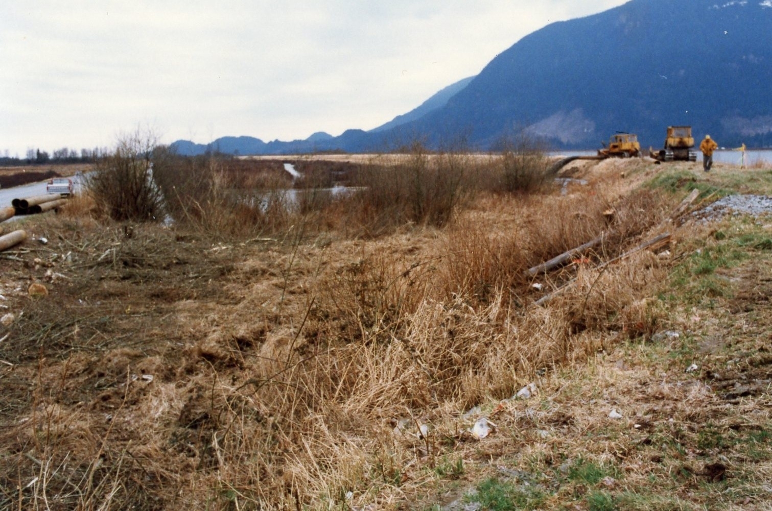
The fifth photo shows a Dyke on the right side with a man and two machines, the road is on left side.<\/p>\r\n
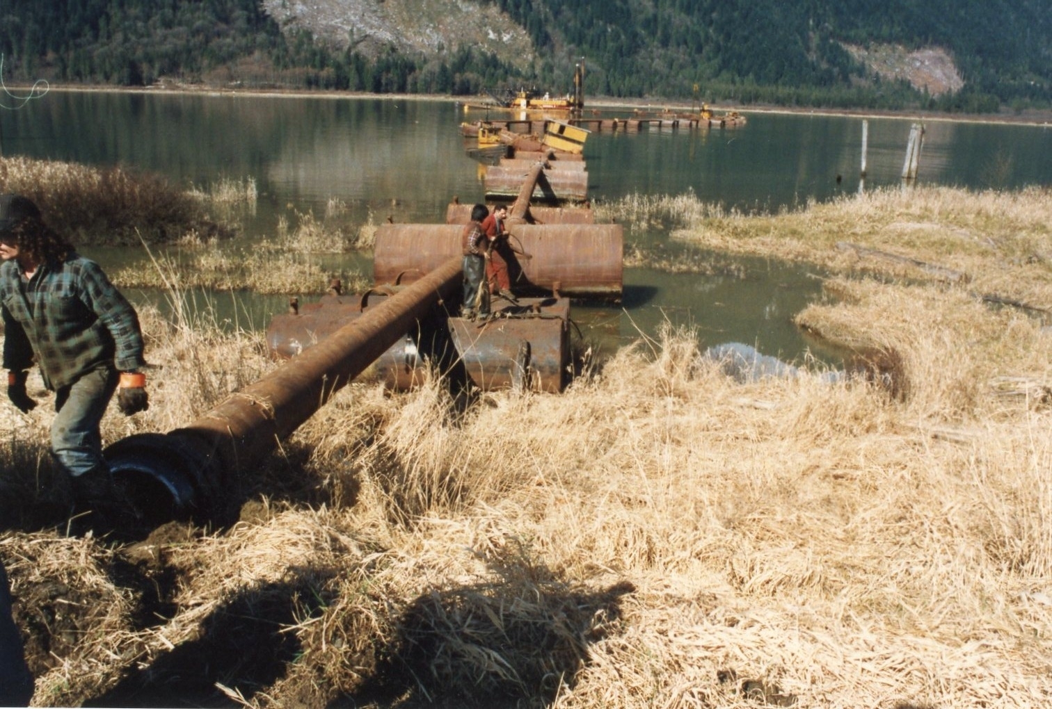
The sixth photo shows pipes extending across a river. Three unidentified men are in the foreground.<\/p>\r\n
<\/p>\r\n
<\/p>\r\n
<\/p>","SEO_LINK":"bloms-crossing","VIDEO_LINK":"","SOUNDCLOUD_LINK":"","IMG1":"1523486538_main_1bloms-crossing.jpg","IMG2":"1523486538_main_2bloms-crossing.jpg","IMG3":"1523486539_main_3bloms-crossing.jpg","IMG4":"1523486539_main_4bloms-crossing.jpg","IMG5":"1523486540_main_5bloms-crossing.jpg","IMG6":"1523486540_main_6bloms-crossing.jpg","IMG7":"","IMG1_THUMB":"","IMG2_THUMB":"","IMG3_THUMB":"","IMG4_THUMB":"","IMG5_THUMB":"","IMG6_THUMB":"","IMG7_THUMB":""}X
Blom's Crossing
The history behind the name of Blom’s crossing. Blom’s crossing (previously called New Neaves Road bridge) is named after Jan Blom. He contributed significantly to Pitt Meadows by initiating the construction of Pitt Polder. Blom was born in the Netherlands. As he grew up in a country primarily made up of reclaimed land, the stage was set for his pursuit of bringing new and better dikes to Pitt Meadows. “Polder” is a Dutch word for reclaimed land. The polder is a piece of low land, reclaimed from a nearby river, surrounded by dikes with a controlled water table, controlled by pumps.
Much of the Pitt Poulder area was under water. Prior to Jan Blom and his team’s construction of the dikes, there had been attempts to reclaim land in the Pitt Polder area. In an interview with the Maple Ridge News, Jan Blom reported, “as far as I know they made the first dike there in 1911 with Chinese workers. They were still here from the railway. They finished the whole works just before 1914. Then, of course, the war started.”
“According to Dr. Jan Blom, prior to 1948, gun clubs hunted for ducks in the polder area until it became too wet even for the ducks because the dikes went altogether because of the flood.” (Maple Ridge News, Wednesday, November 1, 1989).
“The water level was so high that Blom travelled by canoe when he first toured the area.” (Maple Ridge News, Wednesday, November 1, 1989).
In an interview, Blom explains how it all began:
I came here in 1947 for the first time. I got an option on the Pitt Poulder land in 1949. I went back to Holland and talked it over with a number of friends and we thought that it would be an adventure to start it. In 1950, we bought the whole thing practically for nothing because it was a lake, and the cost was not in buying it, but in diking it and draining it. (Maple Ridge News, Wednesday, November 1, 1989).
In 1953, “we had 8,000 acres including the Alouette Polder. There were 7,000 acres in the Pitt Poulder.” (Maple Ridge News, Wednesday, November 1, 1989).
The cost in diking required a Dutch company called Pitt Poulder Ltd. to buy land and establish dikes. It was initially a foreign investment until, the cost became so great that “in 1954, Canadian investors came in with the same amount of money” to meet the expense. (Maple Ridge News, Wednesday, November 1, 1989).
Support for the dikes also came from Pitt Meadows residents who in 1956, pitched it to put sandbags on the dike. (Maple Ridge News, Wednesday, November 1, 1989).
Although the financial backing and support of Pitt Meadows residents was present, it was still challenging to overcome natural obstacles like wind. For example, in 1956, “there was a very fierce wind from the north. We didn’t have the new dike yet over Pitt Lake, and it came in through that funnel. The waves came up, and I think it was a fairly high tide too. That’s the year that we came to the conviction that we still should raise the size of the dike.” This experience guided the engineers on the new plans. (Maple Ridge News, Wednesday, November 1, 1989).
The dikes we see today were built during 1957 and 1958.
Blom’s contribution is significant to Pitt Meadows because without his efforts the Pitt Polder area would be less accessible for farming, hunting, recreation, and golf courses.
In 1989, a cairn was dedicated to him in his honour. On June 2001 New Neaves Road bridge was named Blom’s crossing. That year Jan Blom died on August 17.
The first photo is of a gate in front of water at Pitt Polder. The sign says "Pitt Polder Ltd. Private Property No trespassing."
The second photo is of a pipe extending from one side of the dike to the other.
The third photo shows a sign that states "Dyke reconstruction and park enhancement project," with a man standing to the left of the sign.
The fourth photo shows a machine floating down a river on a platform.
The fifth photo shows a Dyke on the right side with a man and two machines, the road is on left side.
The sixth photo shows pipes extending across a river. Three unidentified men are in the foreground.
Details:
Latitude: 49.2708079412667
Longitude: -122.64487339744
Direct Link: https://www.pittmeadowsmuseum.com/locations/bloms-crossing